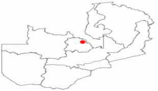
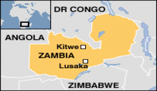
Kitwe
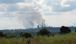
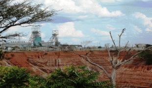
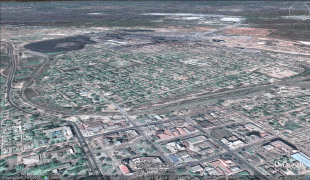
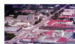
Kitwe is the third largest city in terms of infrastructure development (after Lusaka and Ndola) and second largest city in terms of size and population (after Lusaka) in Zambia. With a population of 517,543 (2010 census provisional) Kitwe is one of the most developed commercial and industrial areas in the nation, alongside Ndola and Lusaka. It has a complex of mines on its north-western and western edges.
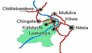
Kitwe is located in the Copperbelt Province and is made up of townships and suburban areas including Parklands, Riverside, Buchi, Chimwemwe, Kwacha, Nkana East, Nkana West, Garneton, Ndeke, Miseshi, Wusakile, Mindolo, Chachacha and Race Course, to mention a few. The city is sometimes referred to as Kitwe-Nkana. Nkana is derived from the name of Senior Chief Nkana of the Lamba speaking people of the Copperbelt province. His area covers the towns of Kitwe, Mufulira, Kalulushi-Chibuluma and Chambishi.
Kitwe has both private and public schools which include Lechwe School, Mpelembe Secondary School, Kitwe Boys Secondary School, Parklands Secondary School, Mukuba Secondary School, Nkana Trust School and Helen Kaunda Secondary School. It is also home to Zambia's second highest learning institution, namely The Copperbelt University.
The name Kitwe comes from the Lamba word Ichitwe (a big head), because long before the industrialisation took place the inhabitants of this place the Lambas found a head of the dead elephant. The town of Kitwe is part of Chief Nkana's area. The Lambas were misplaced when the mining actitivities commenced in this part of the Lambaland in the 1930s.
Kitwe was founded in 1936 in north-central Zambia as the railway was being built by Cecil Rhodes' company. It was first established as an adjunct, non-mining-related but supportive part of an expanding copper-mining centre at Nkana. The expanding copper mines at Nkana made it the dominant centre in the region and Kitwe started building up its size and significance over the years, finally surpassing Nkana as the main centre. The Rhodesia Railways main line reached the town in 1937, providing passenger services as far south as Bulawayo in today's Zimbabwe, with connections to Cape Town in today's South Africa. The line was extended into DR Congo, and from there eventually linked to the Benguela Railway to the Atlantic port of Lobito in Angola, which used to take some of Zambia's copper exports but is currently closed.
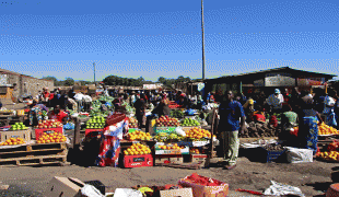
With the upsurge of copper prices in the 1950s Kitwe developed from a small township to the second largest city in Zambia, obtaining city status in 1966. It then developed as an industrial and commercial area and later an important agricultural area. The good central position of the city in the Copperbelt area made it the most popular choice for industrial developers even today in the 2020s.
Kitwe is located in the Copperbelt Province and is made up of townships and suburban areas including Parklands, Riverside, Buchi, Chimwemwe, Kwacha, Nkana East, Nkana West, Garneton, Ndeke, Miseshi, Wusakile, Mindolo, Chachacha and Race Course, to mention a few. The city is sometimes referred to as Kitwe-Nkana. Nkana is derived from the name of Senior Chief Nkana of the Lamba speaking people of the Copperbelt province. His area covers the towns of Kitwe, Mufulira, Kalulushi-Chibuluma and Chambishi.
Kitwe has both private and public schools which include Lechwe School, Mpelembe Secondary School, Kitwe Boys Secondary School, Parklands Secondary School, Mukuba Secondary School, Nkana Trust School and Helen Kaunda Secondary School. It is also home to Zambia's second highest learning institution, namely The Copperbelt University.
The name Kitwe comes from the Lamba word Ichitwe (a big head), because long before the industrialisation took place the inhabitants of this place the Lambas found a head of the dead elephant. The town of Kitwe is part of Chief Nkana's area. The Lambas were misplaced when the mining actitivities commenced in this part of the Lambaland in the 1930s.
Kitwe was founded in 1936 in north-central Zambia as the railway was being built by Cecil Rhodes' company. It was first established as an adjunct, non-mining-related but supportive part of an expanding copper-mining centre at Nkana. The expanding copper mines at Nkana made it the dominant centre in the region and Kitwe started building up its size and significance over the years, finally surpassing Nkana as the main centre. The Rhodesia Railways main line reached the town in 1937, providing passenger services as far south as Bulawayo in today's Zimbabwe, with connections to Cape Town in today's South Africa. The line was extended into DR Congo, and from there eventually linked to the Benguela Railway to the Atlantic port of Lobito in Angola, which used to take some of Zambia's copper exports but is currently closed.
With the upsurge of copper prices in the 1950s Kitwe developed from a small township to the second largest city in Zambia, obtaining city status in 1966. It then developed as an industrial and commercial area and later an important agricultural area. The good central position of the city in the Copperbelt area made it the most popular choice for industrial developers even today in the 2020s.
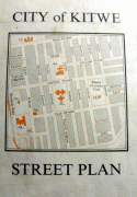
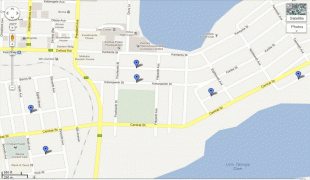
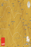
Map - Kitwe
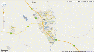
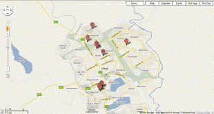
Map


Country - Zambia
 |
 |
| Flag of Zambia | |
The region was affected by the Bantu expansion of the 13th century. Following the arrival of European explorers in the 18th century, the British colonised the region into the British protectorates of Barotseland-North-Western Rhodesia and North-Eastern Rhodesia comprising 73 tribes, towards the end of the 19th century. These were merged in 1911 to form Northern Rhodesia. For most of the colonial period, Zambia was governed by an administration appointed from London with the advice of the British South Africa Company. On 24 October 1964, Zambia became independent of the United Kingdom and prime minister Kenneth Kaunda became the inaugural president. From 1972 to 1991 Zambia was a one-party state with the United National Independence Party as the sole legal political party under the motto "One Zambia, One Nation" coined by Kaunda. Kaunda was succeeded by Frederick Chiluba of the social-democratic Movement for Multi-Party Democracy in 1991, beginning a period of government decentralisation.
Currency / Language
| ISO | Currency | Symbol | Significant figures |
|---|---|---|---|
| ZMW | Zambian kwacha | ZK | 2 |
| ISO | Language |
|---|---|
| NY | Chichewa language |
| EN | English language |